

Description
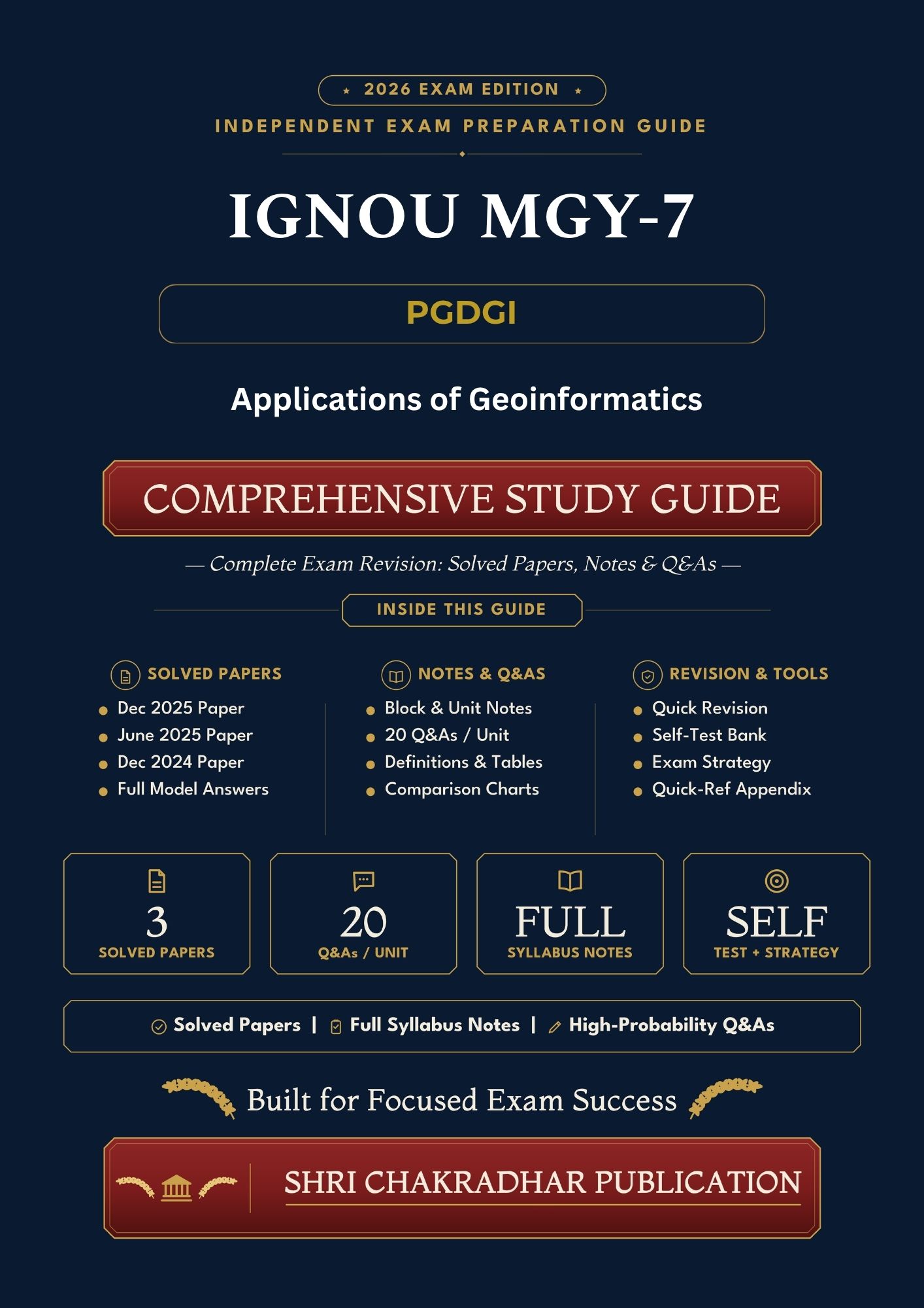
IGNOU MGY-007 Book (Applications of Geoinformatics) translates the verified structure of Applications of Geoinformatics into a practical revision workflow. The aim is to help learners connect concepts, examples and question demands without replacing IGNOU self-learning material.
TEE preparation often breaks down when reading continues but retrieval and writing are postponed; this guide brings those stages into the same study cycle. In this course, links among Remote Sensing of Earth Surface Features, Natural Resources Applications and Hazards and Disasters Related Applications deserve particular attention because they shape both understanding and exam-ready explanation.
For more IGNOU study material, visit IGNOU Study Material. Use this independent guide alongside the latest official IGNOU study material and current examination instructions.
An Overview of the IGNOU MGY-007 Help Book
The fastest way to understand this course is to see its parts before reading them in depth. This section places Remote Sensing of Earth Surface Features, Natural Resources Applications and Hazards and Disasters Related Applications inside the larger logic of Applications of Geoinformatics.
The guide repeatedly asks learners to identify a key term, connect it to a neighbouring idea, choose an illustration and state the significance of the relationship. This produces stronger recall than passive rereading.
Keep a running glossary of course terms, a one-page Block summary and a separate list of examples or scholars so recall is fast during the final revision cycle.
This Book Is Useful For
The guide suits learners who want to turn reading into a visible study plan. It can be used from the beginning of the course or as a focused TEE revision companion.
- PGDGI learners mapping the full MGY-007 course before revision
- Students strengthening recall of Remote Sensing of Earth Surface Features, Natural Resources Applications and Hazards and Disasters Related Applications
- Learners who prefer Unit-wise notes aligned with the verified syllabus
- TEE candidates practising structured descriptive answers and short notes
- Students using official IGNOU material as the primary source and this guide as revision support
What’s Inside This MGY-007 Book
The contents combine verified syllabus organisation with revision tools. Instead of repeating the same information in different formats, each feature supports a separate stage of preparation.
- Course navigation: Block/Unit coverage kept in the researched order
- Key-term revision: important language drawn from Remote Sensing of Earth Surface Features, Natural Resources Applications and Remote Sensing of Earth Surface Features
- Applied explanation: ways to connect theory, text, policy, example or calculation as relevant
- Question rehearsal: outline practice before full-length answers
- Last-week planning: selective revision based on gaps rather than passive rereading
Complete Syllabus Coverage – All 4 Blocks
Use the table as a coverage control sheet: it shows the researched structure that the rest of the guide follows.
| Official Block | Official Block Name | Revision Focus |
|---|---|---|
| Block 1 | Remote Sensing of Earth Surface Features | Revise definitions, major arguments, examples and Unit-wise answer points linked with this Block. |
| Block 2 | Natural Resources Applications | Revise definitions, major arguments, examples and Unit-wise answer points linked with this Block. |
| Block 3 | Hazards and Disasters Related Applications | Revise definitions, major arguments, examples and Unit-wise answer points linked with this Block. |
| Block 4 | Some Other Applications | Revise definitions, major arguments, examples and Unit-wise answer points linked with this Block. |
How This Book Maps to the IGNOU MGY-007 Exam Pattern
The guide maps content to answer tasks rather than promising repeated questions. A strong response starts by identifying what the command word demands and then selecting only the most relevant course material.
For Applications of Geoinformatics, practise a short opening definition, two or three ordered arguments, a course-relevant illustration and a closing line that answers the question directly. Give special attention to Remote Sensing of Earth Surface Features, Natural Resources Applications and Hazards and Disasters Related Applications.
Why Students Prefer Our IGNOU MGY-007 Guide Book & Study Material
Students often prefer a guide that keeps learning and practice in the same sequence. That reduces the gap between reading a concept and using it in an answer.
Compiled & Reviewed By
This guide is prepared and reviewed by the Shri Chakradhar Publication (SCP) Panel of Experts / BK Sahni. Its role is to make a researched course structure easier to revise without suggesting affiliation, endorsement or official status.
Independent explanations, practice questions and revision cues supplement the official material. Current syllabus, assignment and TEE notices should always be checked from IGNOU channels.
How to Use the IGNOU MGY-007 Help Book for TEE and Assignments
Treat the guide as a practice workbook as well as a reading aid. Every study session should end with a small retrieval or writing task.
- Begin with the verified Block/Unit sequence and identify the next unfinished area.
- Create a one-sentence definition for Remote Sensing of Earth Surface Features and a two-sentence explanation for Natural Resources Applications.
- Add one example, text reference, case, policy point or calculation as appropriate to the course.
- Turn Hazards and Disasters Related Applications into a two-minute answer outline before writing in full.
- Compare the finished answer with your headings rather than memorising a fixed paragraph.
- Use the final week for weak themes, especially Remote Sensing of Earth Surface Features and Remote Sensing of Earth Surface Features.
High-Probability Questions from IGNOU MGY-007 (Sample)
The following prompts are revision exercises, not predictions. They sample the major concepts and question actions that a learner should be able to handle after studying the course.
- Explain Remote Sensing of Earth Surface Features with reference to Applications of Geoinformatics.
- Discuss the main issues connected with Remote Sensing of Earth Surface Features and give suitable examples.
- Explain Natural Resources Applications with reference to Applications of Geoinformatics.
- Discuss the main issues connected with Natural Resources Applications and give suitable examples.
- Explain Hazards and Disasters Related Applications with reference to Applications of Geoinformatics.
- Discuss the main issues connected with Hazards and Disasters Related Applications and give suitable examples.
- Explain Some Other Applications with reference to Applications of Geoinformatics.
- Discuss the main issues connected with Some Other Applications and give suitable examples.
Score each outline for relevance, sequence and evidence. A weak outline is a signal to return to the course material before spending time on a full-length response.
IGNOU MGY-007 Sample Question Paper (TEE Format Template)
This mock layout gives you a set of course-focused prompts under one practice session. It should be adapted to the latest official TEE pattern.
Practice instruction: Attempt the set under a self-imposed time limit and follow the latest official pattern for question choice and marks.
- Q1. Explain Remote Sensing of Earth Surface Features with reference to Applications of Geoinformatics.
- Q2. Discuss the main issues connected with Remote Sensing of Earth Surface Features and give suitable examples.
- Q3. Explain Natural Resources Applications with reference to Applications of Geoinformatics.
- Q4. Discuss the main issues connected with Natural Resources Applications and give suitable examples.
- Q5. Explain Hazards and Disasters Related Applications with reference to Applications of Geoinformatics.
- Q6. Discuss the main issues connected with Hazards and Disasters Related Applications and give suitable examples.
- Q7. Explain Some Other Applications with reference to Applications of Geoinformatics.
- Q8. Discuss the main issues connected with Some Other Applications and give suitable examples.
After the session, review three things: whether the command word was answered, whether the course terminology was accurate, and whether the conclusion actually resolved the question.
Related IGNOU MGY-007 Additional Supports
The following four support categories can be used separately from the study guide when a learner needs more targeted practice.
- IGNOU MGY-007 Solved Assignment
- IGNOU MGY-007 Handwritten Assignment
- IGNOU MGY-007 Solved PYQs
- IGNOU MGY-007 Solved Guess Paper
Delivery, Returns & Payment Options
The study guide is a physical A5 paperback unless the product page states otherwise. Courier coverage, dispatch timing and payment choices are those available on the website for the delivery address.
Check the current store policy before purchase. Where a legitimate damage or printing issue occurs, the order and parcel details help support review the request efficiently.
How Students Use This Guide
Active recall produces more value than repeated reading. A practical routine is to read a small segment, close the material, reconstruct the headings and then test the reconstruction through a question.
For difficult areas such as Remote Sensing of Earth Surface Features and Remote Sensing of Earth Surface Features, write the key term on one side of a card and the explanation, example and significance on the other. Retest cards that still require prompts.
Free Downloads: IGNOU MGY-007 Exam Support PDFs
Use IGNOU resources to verify the current course and use this book to shorten revision and organise practice. Keeping those roles separate helps maintain academic accuracy.
- Official IGNOU/eGyanKosh self-learning material for MGY-007
- Current assignment booklet for the applicable session
- Available previous TEE question papers from official IGNOU channels
- Programme guide or prospectus information relevant to PGDGI
Download MGY-007 Study Material Free via eGyanKosh (Step-by-Step)
For original IGNOU study material, start with eGyanKosh. Keep the official PDF folder separate from independent notes so sources remain clear.
- Open the official eGyanKosh course/resource page.
- Check that the page or PDF corresponds to MGY-007 and Applications of Geoinformatics.
- Open the required Block, Unit or course file and verify its title before saving it.
- Store the PDFs in a folder named MGY-007 and keep the verified sequence intact.
- Use the official PDFs for detailed study and this independent guide for Unit-wise revision and answer rehearsal.
Frequently Asked Questions (FAQ)
The FAQ focuses on coverage, revision, medium, practice and the independent status of the guide.
What is the IGNOU MGY-007 book used for?
It is designed to organise Applications of Geoinformatics into a practical revision and writing sequence for MGY-007 learners.
How much of the MGY-007 syllabus is covered?
The guide follows the researched official structure: 4 verified Blocks. Unsupported Block headings are not added where the official hierarchy cannot be confirmed.
Is this an official IGNOU publication?
No. It is independently published by Shri Chakradhar Publication and is not affiliated with, endorsed by, or an official publication of IGNOU.
Can I use this MGY-007 book for TEE revision?
Yes. Use it to revise Remote Sensing of Earth Surface Features, Natural Resources Applications and Hazards and Disasters Related Applications, practise outlines and rehearse complete answers while checking the latest official exam instructions.
Does the guide include solved-question practice?
It includes solved-question guidance, answer frameworks and practice prompts. Students should also work with official previous TEE papers.
What medium is this MGY-007 guide prepared in?
This product is prepared for the English medium shown on the product page, while necessary course terminology is retained for accuracy.
Can this guide replace eGyanKosh material?
No. Use official self-learning material for prescribed study and use this book to organise recall, revision and writing practice.
How should I revise MGY-007 in the final week?
Prioritise weak areas, especially Some Other Applications and Remote Sensing of Earth Surface Features; rehearse key definitions, write short outlines and complete a few timed answers instead of rereading everything.
Where can I get order or soft-copy support?
Use the WhatsApp support link on this product page for availability and order assistance. Academic updates should still be verified through official IGNOU channels.
Conclusion
For Applications of Geoinformatics, consistent revision matters more than last-minute volume. Work through the structure, test recall and keep refining answers until the major themes can be explained without dependence on notes.
To order, visit the IGNOU MGY-007 Book order page. Re-check the latest syllabus, assignment and TEE instructions through official IGNOU channels before examination.
Disclaimer: This is an independent academic study-support resource published by Shri Chakradhar Publication (Pvt.) Ltd. It is not affiliated with, endorsed by, or an official publication of IGNOU. It is designed to supplement, not replace, IGNOU’s official study material. Syllabus and exam patterns may change – please verify the latest information through official IGNOU channels. Students should prepare and submit their own work as per IGNOU guidelines. All trademarks belong to their respective owners.